 I have been using Google Maps quite a bit recently as two of my daughters were house hunting. Each of the MLS listings had a Google Map that allowed me to see where it was located. I would look at the other houses on the street and often switch to Google Earth to see it in a photograph. Soon I would find myself on nearby streets exploring and discovering streets, houses, and neighborhoods I never knew existed. It got me thinking. I realized that Google Maps would be a great way to explore the neighborhood and the world. Here are some ideas to get you started and I'm sure you can come up with many more. Explore Your Neighborhood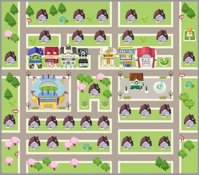 After exploring other neighborhoods, I realized what fun it would be to explore our own neighborhood. You simply type in your address to locate your house. It's so funny to see your house on Google Earth. One time we had left some toys in the yard and could see them in the photo. Once you see your home, you simply expand outward, exploring your street, streets nearby, and soon you will discover streets, stores, and large homes you never knew existed. This is super fun for the adventurous child. Now, of course, when you are finished, you have to get in the car and go see things in person. We found a beautiful street that looked like a dirt driveway from the main road, but it was dotted with lovely old historic homes. We had so much fun seeing them and imaging who lived in them now and who had lived in them long ago. Visit Dream Vacation CitiesWould you like to visit Paris or Rome or London? You can! You can type in one of those cities and see what they look like with the map or Google Earth. You can zero in on neighborhoods, find train or subway stops, and locate places you would like to visit. Children can visit their dream destinations without leaving their homeschool room. Once you explore the city, you can Google places you want to see to explore the websites of castles, cathedrals, museums, and theme parks. What fun! Compare Route with GPS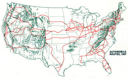 When I was a little girl, we always had our AAA Trip Tik for car vacations. We followed along, trying to figure out where we would be in the next hour. My children grew up with an Atlas in the car. When my kids go on a road trip, they just use their GPS. However, if kids have a tablet in the car, they can pull of Google Maps and follow the route along with the GPS. Hey, what if even before they leave, they go on Google Maps and see all the different routes offered to the destination. Some have toll roads and others just highways. Some avoid interstates and stick to country roads. Let children choose the route they think is best and print it out. Then they can compare the route they chose with the route the GPS takes them. The fun thing for children about having a map of the trip and all the places around the trip is imagining what those places are like. Fog Hill or Blueberry Island are just spots on a map that you will whiz right by, but a child can imagine what those places are like and maybe visit them one day. Well, I've just gotten you started. Please share other ways that you use Google Maps in your home school. Warmly, Meredith Curtis Resources
0 Comments
Leave a Reply. |
AuthorsMeredith Curtis Archives
February 2020
Categories
All
|
Powerline Productions
- Home
-
Books
-
Curriculum
- HIS Story of the 20th Century >
-
High School Courses
>
- Economics, Finances, & Business >
- American Literature & Research
- British Literature
- Who-Dun-It Murder Mystery
- Foundations of Western Literature
- Communication 101: Essays & Speeches
- Old Testament Survey
- Worldview: Understand the Times Workbook
- Drama
- Career Choices & the College Decision
- Real Men 101
- Real Men 102
- Real Men 103: Leadership
- God's Girls 101
- God's Girls 103
- God's Girls 104: Motherhood
- God's Girls 105: Homemaking
- Travel God's World Geography >
- Government
- Unit Studies >
- Teach History the Fun Way >
- Families Learn Together American History >
- STEM Notebooking Pages
- Middle School Courses >
-
Bible
- Cozy Mysteries
- Blog
Photos from cloudzilla, Fil.Al, vaniljapulla, m01229, Ian D. Keating, (Imagine) 2.0, Theo Crazzolara, RomitaGirl67, RomitaGirl67, Gonmi, moonlightbulb, RomitaGirl67, Amydeanne, Salva Martinez, Graham Ó Síodhacháin, Ruth and Dave, infomatique, MsSaraKelly, moonrat42, {Guerrilla Futures | Jason Tester}, Monica's Dad, kennethkonica, o palsson, Tourismusregion Katschberg, wuestenigel, COD Newsroom, ANBerlin, Henri Photography, Tourismusregion Katschberg, Corey Ann, *_*, diannlroy.com, Theo Crazzolara, DaPuglet, terren in Virginia, George M. Groutas, Bunches and Bits {Karina}, Anders Ruff Custom Designs, ¥§•ªˆ¨ˇ© LOVE © ˇ¨ˆª•§¥, srqpix, inkknife_2000 (8 million views +), judy dean, ANBerlin, Phil Roeder, Base Camp Baker, Anders Ruff Custom Designs


 RSS Feed


